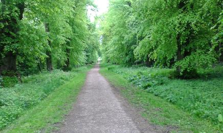
Summer was really here with a super day in prospect and the forecasters saying we could have up to 24C in the afternoon. It started with a hasty plan on Saturday to either take our bikes or walk along the nearby canals to the pub for Sunday lunch and return by the same route.This could take a couple of hours in each direction…tops! Flat, straightforward no hassle! Good news too it was Lesley's idea so no blame attached to me, except, I chose to modify the route and take in a few hills and some extra miles just to add to the pleasure. We started from our home but equally, start from Wendover and walk up via the footpath that rises from Tring Road almost opposite Tesco Express and into and around a small estate aiming up and left with infrequent footpath signs to find Beechwood Lane, trying not to be tempted by the newly refurbished playground on the left, complete with pirate ship and zip-wire, but follow the path that is shared by a house drive until it turns right into a short steep marked path covered in roots!
On joining the track at the bottom of Wendover Woods, go right here and follow it for about a mile until it opens out into a clearing used as a log-store by the Forestry Commission who manage the woods. Here there are 2 choices, rising up the cycle-link for a few yards and a footpath sign is just visible in the right corner. This choice number one takes a marked footpath path through the gardens of superb Chiltern properties, who's owners are probably not too happy they have inherited this right-of-way with the potential of an army of ramblers invading their privacy seven-days-a week! The footpath however, will take you parallel with Hale Lane avoiding the small amount of traffic that uses my second choice of turning down the track for a few yards to turn left back on yourself and follow Hale Lane as far as the next turn point that comes in just over 1/2 mile. So the choice is yours, homemade styles, steep landscaped banks, horsey paddocks, reclining chairs and trampolines or the quiet lane and views over the farms and valley. Regardless of choice just after the track entrance to Wendover Woods take the footpath again parallel with the lane, passing cottages, through gates, across a field and then though someone's well manicured lawn. Do not be tempted to use the inviting swing chair but keep to the path, go though a gate back onto Hale Lane. Care is needed at the turn left point to keep to the correct choice of 3 paths. The path we took was the furthest on a mini-junction of bridleway and paths. Up hill here until crossing a style to your right and into a wonderfull valley where the field usually has sheep or cows grazing. Climbing to the and keeping to the right of adjacent woods ignoring the footpath across the field that follows the line of electric poles but keep ascending until you see a kissing gate at the top of the field, look back and admire the view before going through the gate and keep the upward climb staying alongside and to the right of our old friend, the Ridgeway, running lower down in a well worn ditch. Ignore adjoining paths to the right and merge with the Ridgeway after a few hundred yards. It's all Ridgeway now for 5-6 miles but the walk was superb on this sunny Sunday. Being the weekend there were many more people on the whole of our route than we would expect to find on a week day. This sometimes adds to the enjoyment when perhaps you don't need a 'fix' of solitude and just seeing people out enjoying the surroundings rather than cooped up in front of the box, their children fixated on hand held thingys! As I said the next section is all Ridgeway and no need for navigation due to the frequent and recognisable way-marking posts. This gives you ample time to concentrate on the fields and superb woods of Tring Park with ample views over the Aylesbury Vale and beyond. Regular seats have been placed along King Charles Ride for a morning flask, snack or banana break.
Tring Park shares the venue and paths with the Saturday morning 'Park Run' so if you are on a Saturday walk and it's around 9 to 9:30am you will share the track with 100 or so fit and trying to be fit runners on this somewhat hilly 5ks circuit. Other things to look out for are the made from branches porch with quirky rhymes and an obelisk slightly off the Ridgeway called "Nell Gwyn's" monument, although there appears to be no connection to the maid of certain repute so it leaves one wondering why it has that nickname in the first place! Crossing the road to Wiggington its down hill and over the high footbridge on the busy dual carriage A41 taking away the mayhem traffic would have caused to the towns and villages around Berkhamsted and Tring if this bypass hadn't been built. Passing by the side of the grounds of Pendley Estate and over the now quiet old renamed A41 before the short walk to the Grand Union Canal, joining the tow-path after crossing over the Aldbury road taking the right hand side. This cutting must have taken some doing by the navvies with a very high sided cutting and banks accompanying the canal walk for almost 2 miles. Switching sides over a bridge before moored canal boats indicating habitation and the welcome spectre of the Grand Junction Arms.  Being a Sunday, the small queue at the bar for food was to be expected and we chose to sit inside as the sun-worshippers were too busy swotting sleepy wasps and rubbing-on suncream to enjoy their food and we had had a good fix of alfresco already. The short wait for our food was mellowed with a decent pint of Wainwrights golden coloured bitter, the name was very apt today but I am not sure the man himself would have been found walking in the Chilterns. Roast salmon with all the trimmings including even Yorkshire Pud would you believe. It was really superb. We finished off our beers out in the garden watching the canal boats mooring on this popular stretch which is near to Startop's End and locks, the highest point the canal takes over the Chilterns. A few hundred yards on is Wilstone reservoir with its walks, bird-watching hides and the popular water-side cafe however we only walked just beyond the workshops as far as the Wendover Arm Junction, our next turn left under the bridge to head back towards home knowing we were well refreshed and well over half way.
The Wendover arm is much quieter as only the 1st mile or so is navigable. Building of the canal started in 1793 a very early construction that was initially used as a water 'feeder' for the rapidly expanding commercial Grand Union Canal. However plagued with problems of leaking and the costs to keep shoring up meant that despite many wharfs being constructed for transportation of goods, it eventually closed in 1904.
 Work started to reopen the canal in 1985 and is continuing today, in fact several construction vehicles were being operated by the canal trust volunteers on a section we passed through near Drayton Beachamp. On the short navigable section several narrow boats were enjoying the canal and groups of people were out fishing and walking. Heygates the well known miller, is still operating on the bank on the other side to our tow-path, just after Little Tringford. This gives a real feeling of what the commercial side of a canal used to be like. Both the canal and our path came to an abrupt end with the basin being made wide enough to turn the longer narrow boats around in and will possibly be used for moorings in the future. We had to double back and up onto the bridge, following the road and a newly cut footpath to keep walkers safely away from the narrow lane before crossing and resuming our way back to Wendover walking beside the canal. Where sections are complete they are filled with crystal-clear water fed from its chalk stream source in the Chilterns. This clarity of the water allows you to see a forest-like world of river plants and meandering shoals of fish, today swimming in the sparkling sunshine.
Sections of the canal now looked almost finished ready to join up sometime in the future. Seats line the path, donated in memory of canal volunteers as well as plaques to people and restoration sponsors. It looks like its been a hard graft and will be for the foreseeable future. Crossing the A41 for the second time but this time underneath on a newly constructed bridge where part of the diverted canal was also reconstructed, possibly as part of the road planning agreement. The path continues on into the southern end of Aston Clinton. A smart landscaped garden on the opposite side has a rather lifelike crocodile on the bank, either to ward off trespassers or more likely, just for the fun of it. What gave the game away to us was the monkey it had in its clutches was much too bright red to be real! The path rises and crosses the old A41 as the bridge here is just a functional round gully and will need extensive work if a barge is to pass underneath. Taking the left bank now as the right bank has the rear gardens of some fortunate home owners, many have gone to great lengths to use the canal as part of their landscaping with chill-out swing seats on patios, wooden jetties protruding into the water, small rowing boats, gazebos and countless statues and riverside stuff to add to the real charm of this section. Lilly-pads and reeds with views over the fields towards the Chilterns make this an ideal spot for those in their gardens to just whiling away the hours.
The way back follows the canal with remnants of the Rothschild workings on the canal where bricks were transported to build one of their many palatial houses in the area, that sadly has long since been demolished. A narrow section shows signs where leaks on the canal were stemmed but seemingly all in vain. A choice now for those that joined the walk in Wendover. We branched off left just after a less than pretty rear view of a car scrap yard with scintillating glimpses of stacked cars we used drive 10 years ago or perhaps less now! Our path today extends from the bridge and takes a slight angle to the right through the woods with frequent signs forbidding you to stray as you would be in breach of the official secrets act. As you probably realise this is MOD land that surrounds Halton House used by the RAF officers and a donation by Rothschild's early in the last century for their use. If you were to have strayed you would see a magnificent example of a French styled chateaux built of course by Rothschild. As this is a working house there are very infrequent openings to the public, perhaps just as little as once per year when Halton village has a fete or other special occasion. Keeping to our path, it wends it way upwards joining twice but only briefly the tarmac drive into Halton House, before reaching the busy main road into Wendover.
We crossed over directly opposite into a driveway with a track that leads eventually up to the 'Cafe in the Woods'. Take this track for only just a few hundred yards before turning off to the right on a well defined footpath through a lovely Yew tree 'tunnel' eventually keeping parallel to the fenced-off RAF Halton Camp to your right. Don't take the perimeter path unless you want a sneak look at the rear of the camp, which incidentally is still a right of way, but take a track in the woods marked for horses with a white horseshoe. Ignore all of the tracks to the left and right until after approximately 2 miles passing by new houses & apartments visible through the trees and an earlier ex RAF housing development folioed by a small playground and green, you will find the footpath down into Wendover just after a lovely cottage with one of the best views of the Chilterns. All that's left is completing the circuit back to where you came from earlier today!
For those that take the other choice: After the scrap-yard continue on the tow-path passing one of the many superb RAF sports fields on the left and going under 2 iron blue painted Rothschild bridges with the Halton airfield and hangers on the right. Halton village is above the second bridge if you wish to break the journey late in the day to view the nearby Halton church and the 'best kept' village. Continue on passing a nice nature reserve, keeping to the tow path for another mile before the canal comes to an abrupt end with just the chalk stream feeder, water-falling into the arm. Take the footpath out onto Wharf Road, turn right down to the main Aylesbury Road and left back up into Wendover village (or is it a town).
Useful information:
Please use an appropriate OS map or guide, all of the distances and descriptions mentioned are approximate and can change so check your route first and be prepared to alter it. 15 miles is long if you are not used to distances and there will be a bit more depending on where in Wendover you start from. Although some of the following is obvious: wet weather can make the paths muddy adding to your 'effort' required. Check out on the web for pub opening and food serving times. Buses are infrequent on Sundays. Don't overdo it, shortening the route is easy at many stages especially if the body and spirits are telling you something!.
Much more information on the Wendover Arm Trust and the work they are undertaking by following the link: http://www.wendoverarmtrust.co.uk Walk as of August 2015